
Choosing the Right Surveying GPS Equipment Supplier for Precision Results
In the world of land surveying, geodesy, and construction, precision is not just a goal—it is a requirement. The accuracy of your data depends heavily on the quality of your tools and the reliability of your surveying gps equipment supplier. Whether you are conducting a large-scale urban mapping project or a detailed boundary survey, having high-performance GNSS receivers and controllers can significantly reduce errors and save operational costs. In this guide, we will explore how to identify a top-tier supplier, the essential features to look for in modern GPS gear, and how to optimize your surveying workflow for maximum efficiency.

The Role of a Professional Surveying GPS Equipment Supplier
A reputable surveying gps equipment supplier does more than just sell hardware; they provide a comprehensive ecosystem of support. From pre-sale technical consultation to after-sales calibration and software updates, the supplier ensures that your equipment maintains its accuracy over time. High-quality suppliers prioritize the integration of multi-constellation support (GPS, GLONASS, Galileo, and BeiDou), which is critical for maintaining a signal lock in challenging environments like dense forests or "urban canyons." By partnering with an expert provider, surveyors can ensure their hardware is compatible with the latest RTK (Real-Time Kinematic) and PPK (Post-Processed Kinematic) technologies.
Industry Insight: Modern GNSS receivers now utilize "Tilt Compensation" technology, allowing surveyors to measure points without perfectly leveling the pole, which increases productivity by up to 30% in difficult terrain.
Essential Features to Demand from Your GPS Equipment
When browsing the catalog of a surveying gps equipment supplier, you should look for specific technical benchmarks. First, check for IP67 or IP68 ratings to ensure the equipment can withstand dust and water immersion. Second, evaluate the battery life; field work is often grueling, and a receiver that lasts a full 12-hour shift is invaluable. Third, ensure the software interface is intuitive and supports seamless data export to CAD or GIS platforms. The synergy between hardware durability and software flexibility defines the overall ROI of your investment.
Key Technical Checklist:
• Multi-frequency, Multi-constellation tracking
• Rapid initialization time (Cold start < 45s)
• High-precision internal IMU for tilt correction
• Integrated LTE/4G for NTRIP corrections
Comparing RTK vs. PPK Solutions from a Leading Supplier
Depending on your project needs, your surveying gps equipment supplier will likely offer both RTK and PPK options. RTK provides centimeter-level accuracy in real-time, making it ideal for staking out points. However, it requires a constant communication link between the base and rover. PPK, on the other hand, records raw data for later processing, which is perfect for drone mapping or areas with zero cellular coverage. Choosing the right method depends on your specific environment and accuracy requirements.
Optimizing Workflow with a Surveying GPS Equipment Supplier
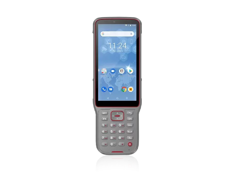
Efficiency in the field is about reducing "dead time." A top-tier surveying gps equipment supplier helps you optimize your workflow by providing cloud-based data management tools. Instead of manually transferring files via USB at the end of the day, modern systems allow for real-time synchronization. This means office engineers can begin processing data while the field crew is still on-site. Furthermore, the use of high-precision controllers with sunlight-readable screens ensures that data entry is fast and error-free, regardless of the weather conditions.

Technical Specifications of Professional GNSS Gear
When evaluating different models from your surveying gps equipment supplier, the technical specification sheet is your best friend. You should pay close attention to the "Channel Count"—more channels generally mean better signal tracking in obstructed areas. Additionally, the "Update Rate" (usually measured in Hz) determines how frequently the position is recalculated, which is vital for moving-point surveys. Below is a typical specification table for a professional-grade GNSS receiver.
Maintaining Long-Term Accuracy and ROI
Buying the gear is only the first step. To maximize the lifespan of your investment, regular maintenance is essential. This includes keeping firmware up to date to take advantage of new satellite constellations or algorithm improvements provided by your surveying gps equipment supplier. Calibration checks should be performed periodically to ensure the IMU and electronic levels are operating within specified tolerances. By following a strict maintenance schedule, you avoid costly downtime and ensure that every measurement taken in the field stands up to professional scrutiny.
Conclusion: Elevate Your Precision with NCTNAV
Finding a reliable surveying gps equipment supplier is the foundation of any successful geospatial project. By prioritizing multi-constellation support, rugged durability, and professional after-sales service, you can ensure that your data is accurate, your team is efficient, and your projects are completed on time. Whether you are upgrading your current fleet or starting a new venture, investing in high-precision GNSS technology is the most effective way to future-proof your surveying business. Choose quality, choose precision, and choose a partner that understands the demands of the field.
Frequently Asked Questions (FAQs)
How do I choose between a single-frequency and multi-frequency receiver?
Multi-frequency receivers are significantly superior for professional surveying. They can track multiple signals from the same satellite, which allows the receiver to correct for ionospheric delays—the primary source of error in GPS positioning. While single-frequency units are cheaper, they are prone to larger errors and slower convergence times. If your work requires centimeter-level precision, always opt for multi-frequency equipment from a professional surveying gps equipment supplier.
What is the importance of Tilt Compensation in GPS surveying?
Tilt compensation, typically powered by an internal IMU (Inertial Measurement Unit), allows the surveyor to take accurate measurements even if the range pole is not perfectly vertical. This is a game-changer when surveying points that are inaccessible—such as the corner of a building or a point under a dense tree canopy. It eliminates the need for constant leveling, which speeds up the data collection process and reduces operator fatigue without sacrificing precision.
Does the supplier provide software training for the equipment?
Yes, a professional surveying gps equipment supplier like NCTNAV typically provides comprehensive training. This includes how to set up the base station, configure the rover, and use the field software to collect and export data. Because GNSS technology evolves rapidly, ongoing training and access to updated user manuals are critical for ensuring your team uses the equipment to its full potential.
What should I check before purchasing GNSS equipment?
Before purchasing, you should verify three main things: first, the compatibility of the equipment with your existing software and data formats; second, the availability of local technical support or a reliable warranty program; and third, the actual performance in your specific working environment (e.g., high canopy or urban areas). Requesting a demo or a trial period from your supplier is the best way to ensure the hardware meets your specific field requirements.