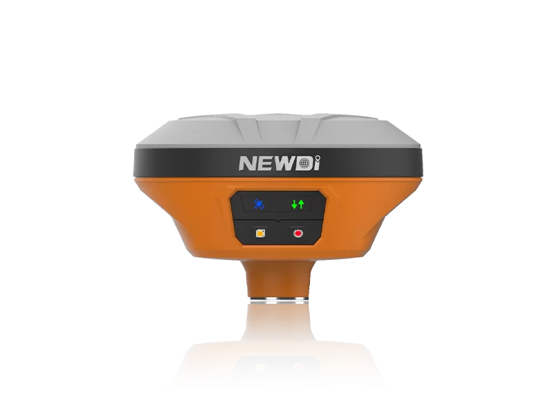

The global surveying industry is evolving rapidly as digital construction, smart infrastructure, and geospatial intelligence become central to modern engineering projects. Across transportation, urban planning, mining, and construction sectors, professionals increasingly rely on advanced surveying technologies to improve measurement accuracy, project coordination, and operational efficiency.
At INTERGEO 2024, intelligent surveying systems have become one of the most discussed topics among international contractors, distributors, and engineering companies. Among the technologies attracting strong attention are modern total station systems, which now combine optical precision, digital workflows, wireless communication, and GNSS integration into a single surveying platform.
As infrastructure projects become more complex and data-driven, intelligent total stations are playing a critical role in supporting faster, safer, and more accurate field operations worldwide.

What Is a Total Station?
A total station is an electronic surveying instrument that combines angle measurement, distance measurement, and digital data processing into a single platform used for construction layout, mapping, engineering surveys, and infrastructure development.
Modern total stations are significantly more advanced than traditional optical instruments. Today’s systems often include:
· Electronic distance measurement (EDM)
· Digital data storage
· Wireless communication
· Robotic tracking
· Imaging functions
· GNSS compatibility
· Cloud-based workflow integration
These capabilities allow surveyors to collect, process, and transfer field data more efficiently while reducing manual errors during measurement tasks.
Total stations are widely used in:
· Construction layout
· Road engineering
· Tunnel surveying
· Bridge construction
· Land mapping
· Structural monitoring
· Mining operations
As surveying workflows continue becoming more digitalized, total stations remain essential tools for high-precision measurement and project coordination.
Why Digital Surveying Is Growing Worldwide
Global infrastructure projects increasingly demand higher efficiency, tighter tolerances, and real-time data collaboration. Traditional surveying workflows often involve repeated manual measurements, paper-based coordination, and time-consuming data transfers.
Digital surveying technologies help solve these challenges by integrating measurement equipment with software platforms, GNSS positioning, and intelligent project management systems.
Several industry trends are accelerating the adoption of intelligent surveying solutions:
· Smart city development
· BIM-based construction
· Digital twin technologies
· Autonomous construction equipment
· AI-assisted infrastructure planning
· Real-time cloud collaboration
At INTERGEO 2024, many international buyers are focusing on surveying systems that can seamlessly integrate into connected construction ecosystems while supporting accurate and efficient field operations.
Key Features of Modern Robotic Total Stations
Modern total stations are designed not only for precision measurement but also for workflow automation and digital collaboration.
Key Features Include:
· High-precision angle measurement
· Reflectorless distance measurement
· Automatic prism tracking
· Integrated imaging systems
· Wireless data transmission
· GNSS integration support
· Robotic operation capabilities
· Real-time field data synchronization
· Cloud-compatible surveying workflows
These technologies help reduce setup time, improve measurement consistency, and support more efficient coordination between office and field teams.
For large infrastructure projects, robotic total stations can significantly improve productivity by minimizing manual intervention and simplifying repetitive measurement tasks.
Total Station vs GNSS Receiver: What’s the Difference?
Although both technologies are widely used in surveying, total stations and GNSS receivers serve different purposes in field operations.
Feature | Total Station | GNSS Receiver |
Measurement Method | Optical + EDM | Satellite positioning |
Accuracy in Dense Urban Areas | Excellent | Signal may be affected |
Construction Layout | Highly suitable | Suitable |
Long-Range Open-Area Surveying | Moderate | Excellent |
Tunnel & Indoor Applications | Strong performance | Limited |
Prism Tracking | Supported | Not applicable |
In many modern projects, contractors combine total stations with GNSS systems to achieve higher efficiency and improved positioning flexibility across different environments.
How Intelligent Total Stations Improve Construction Accuracy
Accurate surveying is essential for reducing rework, maintaining structural quality, and ensuring efficient project execution.
Modern intelligent total stations improve construction workflows by enabling:
· Faster site layout
· Real-time coordinate verification
· Reduced manual measurement errors
· Improved alignment accuracy
· Better cross-team collaboration
· More efficient data management
For example, in road construction projects, surveyors can use robotic total stations to quickly verify alignment and elevation data during layout operations. In high-rise construction, integrated digital measurement systems help maintain structural precision across multiple floors and construction phases.
As construction tolerances become increasingly strict, digital surveying systems are becoming critical components of modern engineering workflows.
NEWDI’s Surveying Solutions for Global Projects
Shanghai Newdi Navigation Technology Company Limited focuses on developing intelligent surveying and positioning solutions for international markets.
Established in 2016, the company has expanded its presence across multiple regions, supporting distributors, engineering contractors, and infrastructure projects with advanced geospatial technologies.
NEWDI’s product ecosystem includes:
· Total station systems
· GNSS receivers
· Surveying accessories
· Construction positioning solutions
· Intelligent field measurement technologies
The company also supports OEM and ODM cooperation for global partners seeking customized surveying equipment aligned with regional market requirements and software ecosystems.
Its engineering and support teams focus on product reliability, measurement accuracy, and practical field usability across complex construction environments.
What International Buyers Look for at INTERGEO 2024
At INTERGEO 2024, international buyers are increasingly evaluating surveying suppliers based on several critical factors:
Product Reliability
Construction and engineering projects require stable performance in demanding outdoor environments.
Digital Integration
Surveying equipment must support modern construction workflows, including BIM platforms, cloud collaboration, and GNSS compatibility.
Technical Support
Global distributors and contractors prioritize suppliers capable of providing long-term technical assistance and training.
Certification and Compliance
CE certification and international compliance standards are increasingly important for global procurement decisions.
Customization Capability
Many distributors seek OEM and ODM partnerships that allow localized branding, firmware adaptation, and workflow customization.
As intelligent construction technologies continue evolving, suppliers capable of delivering flexible and scalable surveying solutions are receiving stronger attention across global markets.
Why CE Certification Matters in Surveying Equipment
CE certification plays an important role in ensuring that surveying instruments meet international standards related to:
· Product safety
· Electromagnetic compatibility
· Operational reliability
· Environmental compliance
For international buyers, certified equipment helps reduce procurement risks while simplifying market entry into Europe and other regulated regions.
In the surveying industry, certification also reflects a manufacturer’s commitment to quality control and long-term product stability.
As global infrastructure investment continues growing, compliance standards are becoming increasingly important in international surveying equipment supply chains.
Future Trends in Intelligent Surveying
The future of surveying is becoming increasingly automated, connected, and data-centric.
Emerging industry trends include:
· AI-assisted surveying workflows
· Autonomous construction measurement
· Real-time cloud synchronization
· Digital twin integration
· Smart infrastructure monitoring
· Connected geospatial ecosystems
As these technologies continue developing, intelligent total stations will remain essential tools for accurate field measurement and digital construction management.
Companies capable of combining precision measurement, intelligent software integration, and international compliance will continue shaping the next generation of geospatial technology solutions.
FAQ About Total Station Equipment
What is total station equipment used for?
Total stations are used for construction layout, engineering surveys, land measurement, infrastructure development, and mapping applications.
What is the difference between a robotic total station and a manual total station?
Robotic total stations can automatically track targets and perform measurements with reduced manual operation, improving efficiency and productivity.
Can total stations integrate with GNSS systems?
Yes. Many modern surveying workflows combine total stations with GNSS receivers to improve positioning flexibility and field efficiency.
Why is CE certification important for surveying equipment?
CE certification demonstrates compliance with international safety and performance standards required in many global markets.
What industries use total station systems?
Construction, mining, transportation, infrastructure engineering, urban planning, and land surveying industries commonly use total station equipment.
How accurate are modern total stations?
Modern total stations provide highly precise angle and distance measurements suitable for demanding engineering and construction applications.
As global construction and infrastructure projects continue moving toward digital transformation, intelligent surveying systems are becoming increasingly important for efficient project execution and accurate field measurement. Through advanced total station technologies, integrated digital workflows, and international compliance standards, companies like NEWDI continue supporting the evolution of smarter and more connected surveying ecosystems worldwide.