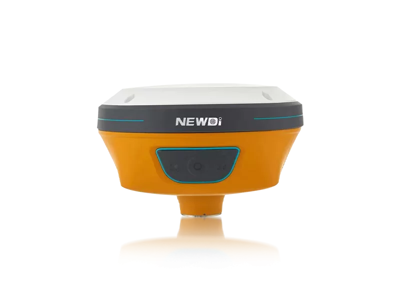
Navigating challenging terrains and capturing precise boundary data often introduces significant friction into daily fieldwork. For professionals in land survey, construction, and agriculture, relying on outdated or unreliable equipment leads to critical mapping errors, prolonged project timelines, and compromised safety. The modern surveyor demands tools that not only withstand the elements but actively simplify complex spatial data collection.
To directly address these operational bottlenecks, Shanghai Newdi Navigation Technology Co., Ltd. (established in 2016) engineered a robust portfolio of high-precision surveying instruments. Driven by a core mission to "make survey easier," our solutions integrate cutting-edge GNSS capabilities, tilt sensors, and rugged IP67/IP68 enclosures. Whether you are conducting intricate marine surveys or deploying UAV mapping strategies, our ISO 9001-certified manufacturing process ensures every unit delivers uncompromising accuracy and reliability in the most demanding environments.
Achieving centimeter-level precision requires strict adherence to top-tier manufacturing and software engineering protocols. A professional mapping device must seamlessly integrate hardware durability with advanced signal-processing algorithms. By continually reinvesting 10% of our annual revenue into Research and Development, we guarantee that our structural and technical frameworks exceed global surveying requirements.
| Performance Metric | Industry Significance | Our Engineering Standard | Advantage |
|---|---|---|---|
| Environmental Resilience | Equipment survival in harsh field conditions | IP67 / IP68 Ruggedness | Total protection against water immersion and dust intrusion, ensuring zero weather-related downtime. |
| Spatial Accuracy | Eliminating costly measurement discrepancies | High-Precision RTK Positioning & Tilt Sensors | Rapid, centimeter-level data acquisition even in obstructed or uneven terrains. |
| Quality Assurance | Preventing out-of-box failures | ISO 9001 Certified & Pre-shipment Final Inspection | Consistent, field-ready reliability right out of the case. |
| Supply Chain Scale | Meeting large-scale fleet deployments | 1,000 Sets Monthly Production Capacity | Agile fulfillment for massive infrastructure and agricultural projects globally. |
Investing in high-end survey equipment transcends immediate hardware acquisition; it is a strategic decision that drives long-term financial performance. By integrating our high-precision GNSS solutions into your workflow, field teams drastically reduce the man-hours required per project phase. This acceleration in data collection translates directly to lowered labor costs and faster project turnaround times.
Furthermore, operational continuity is safeguarded by our expansive global footprint. With distribution spanning over 10 countries and dedicated branch offices providing localized technical support in the USA, Dubai, India, and South Africa, downtime is virtually eliminated. Your fleet operates at peak efficiency, backed by a professional team averaging five years of technical expertise, guaranteeing a superior return on investment year over year.
Related products
Top Selling Products