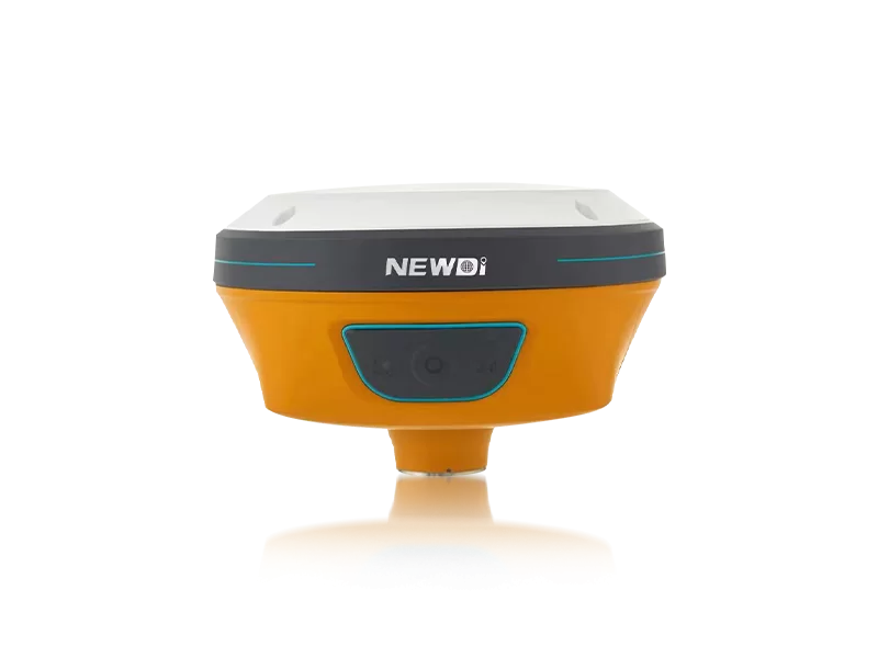
Professionals in land survey, construction, and marine industries constantly battle against environmental limitations, satellite signal blockages, and the daunting task of verifying equipment compliance. The stakes are incredibly high—a single measurement error can cascade into costly project delays or structural misalignments. When you begin the search for a reliable supplier, locating the correct CE certification GPS diferencial CHCNAV or manufacturer becomes the critical first step to eliminating downtime and ensuring operational certainty.
Rather than settling for standard systems that struggle under challenging topographies, modern surveying demands intelligent, ruggedized solutions. Established in 2016, Shanghai Newdi Navigation Technology Co., Ltd. actively resolves these field challenges with a singular mission: to make survey easier. Operating from our Shanghai headquarters with an extensive distribution network spanning over 10 countries, we eliminate the guesswork of high-precision mapping. By producing up to 1,000 sets per month under strict ISO 9001 quality control—including rigorous pre-production sampling and final pre-shipment inspections—we ensure that every GNSS receiver deployed to the field delivers uncompromised accuracy and immediate problem-solving capability.
Technical superiority requires more than just assembling components; it requires a deep understanding of field dynamics. To effectively benchmark a dependable CE certification GPS diferencial CHCNAV or manufacturer, surveyors must evaluate the exact engineering tolerances and ruggedness of the equipment. We channel 10% of our annual revenue directly into Research & Development to stay ahead of industry demands, producing state-of-the-art instruments like the N10 IMU & Visual GNSS Receiver and the C5 GNSS Receiver.
| Performance Metric | Industry Significance | Our Engineering Standard | Advantage |
|---|---|---|---|
| Positioning Accuracy | Determines the baseline reliability of mapping data. | High-precision RTK positioning with integrated Visual GNSS & IMU tilt sensors. | Maintains centimeter-level precision even in obstructed environments, eliminating the need to physically level the pole. |
| Environmental Durability | Dictates survival rate in marine, agricultural, and construction sites. | Strict IP67/IP68 ruggedness ratings across the GNSS hardware portfolio. | Complete defense against heavy dust penetration and continuous deep-water immersion. |
| Quality Assurance | Ensures equipment functions perfectly upon delivery. | ISO 9001 certified protocols with mandatory pre-production and pre-shipment testing. | Zero-defect tolerance guarantees immediate field readiness and extends hardware lifespan. |
| Application Versatility | Adaptability across various heavy machinery and survey formats. | Custom systems like the NG3A Automated Steering System and UES500 Grade Guidance System. | Seamlessly integrates precision GNSS technology directly into agricultural and excavation workflows. |
Transitioning to advanced mapping instrumentation is not merely a technological upgrade; it is a strategic financial decision. Securing equipment from a verified CE certification GPS diferencial CHCNAV or manufacturer significantly compresses project timelines by reducing required man-hours and rework. Global accessibility further protects this investment. With dedicated branch offices providing local technical support in the USA, Dubai, India, and South Africa, downtime is virtually eliminated, ensuring your teams remain productive in core markets across Southeast Asia, Africa, and South America.
The financial trajectory of integrating such high-precision instruments reveals a rapid return on investment. By utilizing automated steering systems and grade guidance technologies, construction and agricultural projects experience an exponential reduction in labor costs while output accuracy climbs. The chart below visualizes the projected operational cost savings and efficiency gains over a 12-month period when utilizing our advanced RTK systems compared to traditional surveying methods.
Related products
Top Selling Products