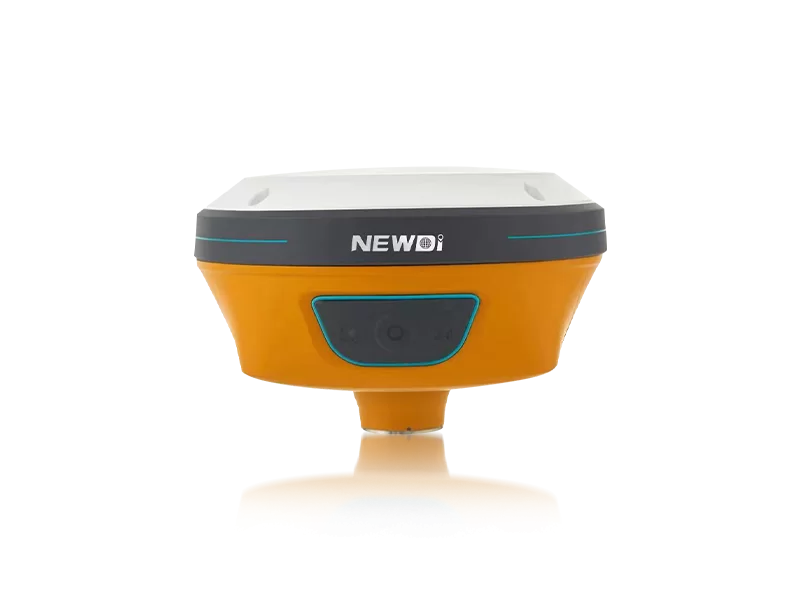
Navigating unpredictable terrains, managing tight project deadlines, and ensuring millimeter-level accuracy are constant challenges for modern engineering and mapping professionals. When field conditions degrade and legacy equipment fails, project downtimes can lead to severe cost overruns. Finding a reliable solution goes beyond simply purchasing a tool; it requires a strategic partnership with a manufacturer that understands the harsh realities of the field.
Founded in 2016, Shanghai Newdi Navigation Technology Co., Ltd. (NCTNAV) was built on a singular mission: to make surveying easier. We recognize that when you are searching for the ideal land survey machine and GPS surveying equipment for sale, you need uncompromising precision backed by rock-solid reliability. By combining advanced GNSS systems with practical field applications, we eliminate the guesswork from construction, marine, and UAV surveying tasks.
The Authority of Experience: Our professional technical and sales team brings an average of 5 years of dedicated industry experience. Supported by a robust ISO 9001 certified manufacturing infrastructure capable of producing 1,000 sets per month, every piece of equipment undergoes strict pre-production sampling and rigorous final inspections before deployment. This means the system you unbox is primed for immediate, flawless operation.
In high-stakes topographical and construction environments, technical specifications are the ultimate differentiators. Our approach to engineering ensures that every product, from the acclaimed N10 IMU to the C5 GNSS Receiver, meets rigorous global standards. By reinvesting 10% of our annual revenue directly into Research and Development, we continuously push the boundaries of spatial positioning technology.
To provide a clear benchmark, we have detailed how our manufacturing protocols stack up against critical industry requirements. When evaluating a land survey machine and GPS surveying equipment for sale, these are the technical pillars that guarantee sustained field performance.
| Performance Metric | Industry Significance | Our Engineering Standard | Advantage |
|---|---|---|---|
| Positioning Accuracy | Essential for boundary definitions, structural layouts, and UAV integrations without drift errors. | High-Precision RTK with built-in IMU & Visual GNSS (Featured in the N10 Series). | Delivers reliable millimeter-level accuracy, even in challenging satellite-obstructed environments. |
| Environmental Durability | Equipment must survive rain, dust, and physical impacts to prevent project delays. | IP67 and IP68 Ruggedness Ratings across core GNSS systems. | Complete waterproof and dustproof protection, ensuring zero downtime in extreme weather. |
| Dynamic Integration | Modern surveys require compatibility with heavy machinery and agricultural tools. | NG3A Automated Steering System & UES500 Grade Guidance System capabilities. | Seamless transition from handheld topography to excavator and tractor automation. |
| Quality Assurance | Inconsistent manufacturing leads to field failures and costly replacements. | ISO 9001 Certification with a strict dual-inspection protocol (Pre-production & Final). | Guaranteed consistency across our 1,000-set monthly production capacity. |
Capital expenditure in spatial positioning technology should not be viewed merely as an operational cost, but as a long-term asset that accelerates project timelines. The true value of top-tier mapping instruments lies in their ability to compound efficiency year over year. When you secure a land survey machine and GPS surveying equipment for sale through our global network, you are investing in a heavily supported ecosystem.
Downtime is the enemy of ROI. That is why our strategic global layout includes branch offices providing localized technical support in the USA, Dubai, India, and South Africa. Coupled with our active presence at premier industry events like Intergeo 2024, FIGAN 2025, and GOLDEN NIVA 2025, we ensure our clients in Southeast Asia, Africa, South America, and beyond have uninterrupted access to the latest innovations—like the NEW TD63 Development Kit—and immediate troubleshooting assistance.
The chart below illustrates the projected long-term value generated through localized support and advanced R&D investments, demonstrating how our engineering directly translates to reduced operational delays and increased surveying efficiency.
Related products
Top Selling Products